Posted Tue, 19/05/2015 - 08:23 by Cap
Many scientific secrets and mysteries of the Arctic Ocean, which excited the best minds of past generations, have been left as a legacy to our era. One of them is climate fluctuations and the influence of the Arctic on the weather in temperate latitudes. It has long been noted that from time to time cold air masses from the Arctic spread to the south. Some of these incursions reach the Black Sea coast at the speed of a train and drastically worsen the weather there.
During such periods, it can be fair to say that the Arctic Ocean is the "key of the weather" for a significant part of our country. However, this “weather key” does not always work. There are also periods when the Arctic experiences powerful intrusions of warmer air masses from the North Atlantic Ocean.
Meteorologists have surrounded the Arctic Ocean with a network of meteorological stations and continuously monitor changes in the weather. Their task is to uncover the reasons why the Arctic either becomes a “weather key” for temperate latitudes or ceases to be one, learn to predict in advance the frequency and power of Arctic invasions on the continents.
arctic ocean map 
Another mystery of the Arctic Ocean is the distribution of waters of various origins and changes in currents. The work of our scientists has already made it possible to find out where and what waters lie, in what ways they spread. And now we need to find out how fast they move and how the speed of currents can change in different years and seasons.
The third most important task is to reveal the laws of changing ice conditions in the Arctic seas. This is very important for navigation in ice.
Our scientists have created an interesting branch of science - the science of ice forecasts, which makes it possible to calculate in advance the ice situation in the seas. What a fascinating thing it is to follow the ice, their movement, growth and melting, rallying and rarefaction. Scientists are conducting these observations in the Arctic from the board of a transport vessel approaching the ice with caution; from a special expedition ship or icebreaker, boldly invading the realm of ice; from the coast of the mainland or a distant island, lost in the vastness of the sea. Recently, they are increasingly taking to the air by plane and in a few hours inspecting vast areas of the seas.

Observations of the behavior of ice are also carried out in quiet rooms, in which multi-colored maps with the ice situation drawn on them lie on the desks. Information about her has just been brought by a radiotelegraph connecting the office with the polar station, the expedition, the ship and the plane. And the feeling of pride in the successes of our science is quite understandable, when scientists, having calculated possible changes in ice, indicate the time for ships to enter the route and the route they will follow, bypassing the heaviest accumulations of ice.
There are other scientific tasks in the field of geography, geophysics and oceanology, which scientists are working on. Now the development of mining in the Northern region is becoming very relevant.
In recent years, many countries have gained interest in the Arctic.
This is mainly due to the fact that huge reserves of oil and gas have been explored here. According to preliminary data, the Arctic contains about 100 billion tons of oil and about 50 trillion. cubic meters of gas. This was the reason for the fact that oil-producing countries began to actively explore new and develop open deposits. As a result, there was even a conflict between Russia and Norway about the zones of ownership. In 2010, Russia and Norway were forced to conclude an agreement on the division of borders in, but the disputes have not yet subsided.
In 2014, Gazprom has already started oil production on the Arctic shelf. In 2014, almost 300 thousand tons of oil were produced, and in general, by 2020, it is planned to expand oil production to 6 million tons per year. The issue of gas production in the Arctic is still open, but scientists from many countries are working on it. Now several expeditions are operating on the territory of the Arctic Ocean. Some of them are not exactly scientific. Most often, their task is to create conditions for the deployment of a military contingent that can influence the political situation in the Arctic. So American submarines are increasingly appearing in
In response to these claims, Russia also does not stand still. Over the past couple of years, the restoration of the presence of Russian military forces in the Arctic has begun. To do this, several old bases are being reactivated and new bases are being built. Thus, the base on Kotelny Island was completely reconstructed, where a practically new military camp and an airfield were built, which had not functioned for 27 years, where Russian Air Force aircraft will be on duty around the clock. The restoration of the Russian military base on the New Siberian Islands has begun, where the presence of the Russian Navy on a permanent basis will be ensured.
The military base and airfield Rogachevo on Novaya Zemlya are being restored and reconstructed. MiG-31 fighters will be deployed here, allowing you to reliably cover the air northern borders Russian Federation. The use of the former nuclear test site in the south of the archipelago is being reviewed.
Seas
The area of the seas, bays and straits of the Arctic Ocean is 10.28 million km² (70% of the total ocean area), the volume is 6.63 million km³ (37%).
Marginal seas (from west to east): Chukchi Sea, Beaufort Sea, Lincoln Sea, Greenland Sea, Norwegian Sea. Inland seas: White Sea, Baffin Sea. The largest bay is Hudson Bay.
Beaufort Sea
The Beaufort Sea is a northern sea with a rather harsh climate, a unique hydro-regime and stunning icy landscapes.
The Beaufort Sea is located between the Canadian Arctic Archipelago in the east and the Chukchi Sea in the west.
It washes the northern coast of Canada and the United States (Alaska Peninsula). This sea was named after the famous English admiral Francis Beaufort. On the whole, the Beaufort Sea does not differ from the Arctic Basin in terms of its physiological and oceanographic parameters and is an integral part of it. But historically the name of the sea has firmly established itself behind it.
The Beaufort Sea is partially located on the continental shelf. It extends along the coastline. In addition, this shelf is the narrowest of all continental shelves among the seas of the Arctic Basin. Its width is only 50 kilometers. Ice under water in the Beaufort Sea - more-boforta-led-pod-vodoiBeyond it, a sharp decrease in the ocean floor begins. The decrease occurs to a mark of 3940 meters. This is the deepest point of the Canadian Basin. Along the coast, the shelf is replete with small islands, mainly consisting of gravel, the height of which does not exceed a few meters above sea level. Also, their size and shape are not constant. They change under the influence of pressing ice and strong coastal currents.
Hirshal and Barter are one of the largest such islands. Their area is 19 and 14 square kilometers, respectively. Many features in the behavior of the microrelief continental shelf the Beaufort and Chukchi uplift seas are explained through the erosive activity of ice, as well as erosion during the Quaternary glaciation phenomena. The shelf is divided into 4 sections by three bottom valleys. The largest in terms of area is Alaska. It reaches a width of 45 kilometers and begins at Cape Barrow.
Three large rivers flow into the Beaufort Sea: Anderson, Colville and Mackenzie. A huge number of small rivers flowing into the sea carry abundant sediment to coastal areas and estuaries, which ultimately significantly affects oceanography. A variety of geological and aeromagnetic data suggest that the bottom of the Beaufort Basin consists almost entirely of a thick layer of sedimentary deposits with a crystalline basement. There is an inclination of the foundation towards the East. Depression is also formed, the cause is the action of sedimentation load.
Hydrological regime of the Beaufort Sea
The Canadian Basin and the Beaufort Basin experience a cyclonic water cycle. It quite strongly affects the entire system of water circulation in the sea. At a great distance from the coast, the speed of the current of the cyclonic circulation reaches up to 2-4 kilometers per day. However, those currents that are directed along the coast of Canada and Alaska are changeable, because they depend on the behavior and nature of local winds. Other clockwise currents bring huge masses of multi-year ice to the coast. This phenomenon makes navigation limited by certain time limits. It is very short and long in the second half of August - September. This fact has a huge impact on the study of the Beaufort Sea and explains the small amount of observational data in this area.
Four main water masses can be distinguished in the sea area. Seasonal changes can be observed in the surface layer of Arctic waters. Changes in temperature and salinity. It depends on the melting and freezing of the pack ice. Deeper than the surface layer, one can observe a stable and uniform distribution of salinity and temperatures throughout the year. The water thickness of the surface Arctic layer is approximately 100 meters. Among all water masses, this one stands out as the coldest. The average temperature in it does not rise to 1.4 degrees Celsius below zero in the summer months, and to minus 1.7 in the winter. Salinity in winter is up to 32 ppm. Below this layer is another, warmer layer. This is the Pacific intermediate water mass entering the Beaufort Sea through the Bering Strait. This creates unique conditions among the waters of the oceans.
Below the intermediate Pacific water mass is another - the Atlantic. The depth of its location is approximately equal to 500-700 meters. These waters are the warmest. Their average temperature is 0 degrees, and sometimes reaches up to 1 degree Celsius. Salinity remains equal to the salinity of deep waters and averages 35 ppm. The temperature at a depth of 500 meters reaches 0 degrees. Further, it decreases with depth. At a depth of 900 meters, bottom waters begin. The salinity of this water mass is homogeneous and practically does not change. Most of the area of the Beaufort Sea is covered by floating ice. But every summer the coastal regions of Canada and Alaska are freed from ice.
You understand that tourism and excursions in the Beaufort region are not particularly developed, but if you have to visit, then have a warm trip!
Greenland Sea
The Greenland Sea belongs to the oceanic marginal sea, which is rich not only in its history, but also in one of the largest fishing areas in the entire World Ocean.
Some scientists continue to argue that this reservoir belongs to Atlantic Ocean, and not the Arctic. Note that the North Ocean water area has very arbitrary boundaries.
For the first time this sea began to be explored since the 70s of the last century. After that, the number of research expeditions in this direction increased. Russians, Norwegians, and Icelanders visited the shores of the basin.
The total area of the reservoir is 1.205 million square meters. km. A more detailed description of the sea was made in 1909 by a Norwegian explorer, Fridtjof Nansen. As for the islands washed by the Greenland Sea, Greenland is considered the largest of them.
Of particular interest to tourists are islands such as Iceland, the Svalbard archipelago and Jan Mayen, famous among polar explorers. If the infrastructure is still developed on the archipelago, only scientists who monitor meteorological stations and radio communications live on Jan Mayen.
Three others are adjacent to the sea - Barents and Norwegian with Vandel. One of the straits runs between the Svalbard archipelago and Bear Island. Thanks to the Danish Strait, the Greenland Sea has access to the Atlantic Ocean.
Greenland Sea photo The Greenland Sea is only part of a single basin, to which the Norwegian Sea also adjoins. Both reservoirs have not quite even relief. Moreover, both basins are united by a single median oceanic ridge framed by basins. The latter are formed with the help of continental slopes and shelves belonging not only to the northwestern part of Europe, but also to Eastern Greenland.
The average depth of the sea bottom is 1640 m, but the lowest point is at a depth of 5527 m. The surface of the reservoir is covered with drifting ice most of the time. This is especially true of the central and northern parts of the Greenland Sea, where modern shipping faces quite serious obstacles to movement.
The washed islands have mostly rocky shores with a rather indented coast structure. Visiting travelers can admire small bays, picturesque fjords and no less beautiful bays. It is in these places that tourists most often observe the so-called "bird markets" of sea birds.
The basin of the Greenland Sea is noticeably isolated from other seas and water basins, especially at great depths. This separation is due to the presence of underwater uplifts. Their dimensions can reach 2000 m. The Iceland-Greenland threshold does not allow the Denmark Strait to go into the deeper regions of the North Atlantic. And the elevations located in the northwestern part of the Spitsbergen archipelago play the role of a separator between the basin of the Greenland Sea and the basin of the ocean.
Hydrological regime of the Greenland Sea
Cold currents prevail in this region, although there are also warm currents such as the Gulf Stream. As a result of this natural feature, the water flow in the central part of the sea moves counterclockwise. Very often the waters are restless due to strong winds. Fogs and icebergs moving in a southerly direction are considered a frequent occurrence here.
As for the structure of waters, it is divided into several types at once. One of the largest is the East Greenland type, which has become widespread throughout the eastern side of Greenland. The coldest waters belong to the Arctic Ocean - their temperature can reach -1.30. The warmest should be considered intermediate waters, whose temperature is 1.50, and salinity - 35 ‰. In deep waters, almost the same salinity is found as on the surface of the sea.
Flora and fauna of the Greenland Sea
A striking representative of the flora of this sea is various kinds of plankton. In addition to these organisms, coastal and diatom algae are often found. Due to the rich food environment in the sea, cetaceans feel good: dolphins, killer whales, giant whales, etc.
In addition to the above animals, seals, polar bears, hooded seals, reindeer and musk oxen can be observed in this area. From the fish world of the Greenland Sea, it is worth highlighting the sea bass, representatives of the cod and herring families, as well as several types of sharks - Greenland, katran and giant. Some scientists have an assumption that the oldest species of the shark family, the frilled shark, can live in the sea.
If desired, lovers of extreme tourism can watch whaling and bird colonies. Also, as a service, you can order a sea excursion or fishing.
Sea of Vandel
The Wandel Sea (informal name) is the most mysterious body of water in the Arctic. Its research is difficult to this day, and there are many "blank spots" in the history of this area.
Wandel Sea (McKinley) photo The sea itself is located between two capes called Nordostrunningen and Pirie Land. Its waters wash the shores of the Spitsbergen archipelago, as well as the islands of Greenland. In addition, the water area is adjacent to such water bodies as the Greenland Sea and the Lincoln Sea. As for the northern boundaries of the water area, then, as such, it does not have them. This reservoir belongs to one of the basins of the Arctic Ocean.
The discovery of the reservoir occurred as a result of another polar expedition, during which the coastal regions of the island of Greenland were thoroughly examined. This event was headed by the famous polar explorer-hydrographer named Carl Frederick Wandel. The open sea was named after him.
In the second half of the 20th century, several more attempts were made to explore the area. The last expedition took place in 2008, however, no special progress was made in the study of the water area. For the same reason, the McKinley Sea can not be found on all maps. Even if it is possible to find any information about him, but it is very scarce and limited to only a couple of lines.
Also on the territory of the reservoir there are two large bays, which are also fjords. Their names are rather unusual - Independence and Dunmark. The total area of the sea is about 57 thousand square meters. km.
This issue is also poorly understood, like the rest of the geographical characteristics of the reservoir. You will hardly find such a sea not only in the Arctic region, but also in the entire World Ocean.
The main problem in studying the water area is that its surface is almost completely covered with ice, and it is not so easy for researchers to get into this area, as is the case with other seas of the Arctic region.
Scientists suggest that the average depth varies between 100-300 meters. Also, researchers tend to think that the reservoir is considered to be this moment almost the deepest in these parts.
As for the bottom itself, it is a kind of underwater cornice, located in front of two large basins - Amundsen and Nansen.
According to its climatic conditions, this water area is very close to the climate prevailing in the internal waters of Antarctica. Almost all year round, the surface of the reservoir is covered with an ice crust, the thickness of which in some cases reaches 15 meters! Something similar is extremely difficult to find in other water bodies of the Arctic Ocean.
The temperature of the waters here generally does not reach zero and even in summer it can remain at a low level. No wonder the McKinley Sea is called the most severe region of the Arctic. Unfortunately, nothing more is known about other features of these waters.
Flora and fauna of the Wandel Sea
The local region remains extremely inaccessible to researchers and everyone who wants to explore this inhospitable area. Due to the harsh climatic features, all living organisms living in the Arctic natural world have been safely preserved. environmental issues also not seen here.
On the surface of the waters here you can often see a polar bear, a seal or a beluga whale. Harp seals are also not uncommon in the area. It is also worth noting that in the Wandel Sea there is a huge number of different organisms of plant and animal origin - plankton. It is these representatives of the living world that are the main food for the fish living here.
By the way, there are more than 100 species of the latter in this region, and many of them include invertebrates. Algae live on the southern coasts of the sea. The main types of commercial fish include flounder, horse mackerel, catfish, sea bass, haddock, mackerel and many others. others
However, we will immediately stipulate that fishing here is not put on a mass flow only for the simple reason that it is difficult even for icebreakers to pass through an ice barrier lying in a thick layer on the sea surface.
Despite this, the most fearless travelers do not mind from time to time to entertain themselves with fishing from the shore or a motor boat. Some tour operators even offer their clients to go on such an extreme form of recreation as an entertainment.
Perhaps the only attraction of this region can be called a research and military base under the very apt name of Nord. You can also enjoy plenty of noisy cries from local bird colonies. Mostly here you can observe such species of birds as kittiwakes, guillemots and guillemots.
Islands
In terms of the number of islands, the Arctic Ocean ranks second after the Pacific Ocean. In the ocean there is (2175.6 thousand km²) and the second largest archipelago: the Canadian Arctic Archipelago (1372.6 thousand km², including the largest islands: Baffin Island, Ellesmere, Victoria, Banks, Devon, Melville, Axel Heiberg, Southampton , Prince of Wales, Somerset, Prince Patrick, Bathurst, King William, Bylot, Ellef Ringnes).
The largest islands and archipelagos:, North-Eastern Land), Novosibirsk Islands (Kotelny Island),), Kong Oscar Islands, Kolguev Island, Milna Land, Vaygach Island.
As early as the beginning of the 17th century. Henry Hudson, William Buffin and other explorers in search of the Northwest Sea Route penetrated very high latitudes. However, the idea of organizing an expedition to the North Pole arose much later. At first, attempts were made to find a path to the pole from the Greenland Sea, and then the search was carried out mainly from the area of Smith's Bay and Kennedy Strait between Ellesmere Island and Greenland. During the British Arctic Expedition of 1875-1876, George Nares managed to lead the ships "Discovery" and "Alert" to the edge of thick pack ice. In 1893, the ship of the Norwegian explorer Fridtjof Nansen "Fram" froze into the cover sea ice in the north of the Russian Arctic and drifted with it to the Arctic Ocean.
Fridtjof Nansen 
When the Fram was closest to the pole, Nansen and his companion Frederik Johansen tried to get to the North Pole, but, having reached 86 ° 14 "N, they were forced to turn back. In 1898, Otto Sverdrup (who participated in the Nansen expedition) landed in the central part of the east coast of Ellesmere Island, where he spent the first of four winterings in high latitudes.During his expeditions, maps of vast areas of the Arctic were compiled, but were not undertaken.But the American Admiral Robert Peary set himself such a task.In 1898, he wintered on aboard his ship Windward almost 100 km north of the point reached by Sverdrup on the Fram Another American, Dr. Frederick Cooke, claimed to have reached the Pole in 1908. Peary claimed to have reached the Pole on April 6, 1909, with his Negro servant Matt Hanson and four Eskimos It is currently believed that neither Cook nor Peary ever actually made it to the Pole.
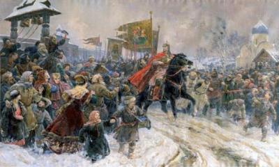
Russian polar explorer - Georgy Sedov

subsequent expeditions.
In the first half of the 20th century Expeditions to the Arctic were carried out for both scientific and sporting purposes. The Canadian government, in order to assert its power, organized patrols on the Arctic islands and created police posts. In 1926, the American Admiral Richard E. Baird for the first time from the base on Svalbard and returned back.
Somewhat later, Baird, the American explorer Lincoln Ellsworth and the Italian aviator Umberto Nobile crossed the Arctic Ocean through the North Pole to Alaska on the airship "Norway". In 1928, Hubert H. Wilkins and pilot Carl Ben Eielson flew in the opposite direction - from Alaska to Svalbard. Two successful flights from the USSR to the USA across the Arctic Ocean were carried out by Soviet pilots in 1936-1937, but the third attempt turned out to be fatal: the pilot S.A. Levanevsky, together with the plane, disappeared without a trace in the icy expanses of the Arctic. In 1937, a polar scientific expedition of a new type was organized under the leadership of ID Papanin. Together with his companions I.P. Shirshov (hydrobiologist), E.K. Fedorov (geophysicist) and E.T. Krenkel (radio operator), he was landed near the pole on a drifting ice floe, on which a tent camp was built. During this expedition, regular meteorological and geophysical measurements and hydrobiological observations were carried out, measurements of the sea depths were made. After a 9-month drift, the detachment was picked up by the Soviet icebreakers "Taimyr" and "Murman" near Jan Mayen Island. Since the 1950s, many such drifting stations have been operating in the Arctic Ocean. The governments of the United States, Canada and the USSR organized long-term research bases on large ice islands, where the ice thickness reached 50 m.
Roald Amundsen

Modern Arctic.
In North America, in Alaska, Canada and Greenland, the establishment of weather and military early warning radar stations has created new jobs for many locals. The construction and maintenance of these stations led to the development of air and sea communications using icebreakers. Communication systems have improved significantly. Today, satellite TV reception is possible in almost all settlements.
Various government programs and administrative measures are aimed at expanding the network of permanent settlements and the gradual elimination of small settlements. The growing interest in the Arctic regions is leading to increased political tension due to their status. In the early 1950s, the Canadian government established police stations and, to assert its sovereignty, built two Eskimo settlements in the high Arctic, Resolute and Gris Fjord. Canadian sovereignty over the waters between the islands of the Canadian Arctic Archipelago was disputed by the United States. Economic interests, which had previously been concentrated mainly in the fishing of marine animals, gradually shifted to the exploration of minerals, especially oil and natural gas. In the 1970s and 1980s, Norway, the USSR, the USA, Canada, and Denmark embarked on large-scale research programs natural resources. Huge projects were carried out in the USSR, and after the discovery of a large oil and gas basin in the north of Alaska, the Trans-Alaska oil pipeline was built.
In the Canadian Arctic, modern technologies were introduced to extract large volumes of oil and gas, but then production had to be sharply curtailed as world energy prices fell below the minimum level at which the use of expensive equipment is justified from economic point vision.

Excitement in the Arctic seas depends on the wind regime and glacial conditions. In general, the ice regime in the Arctic Ocean is unfavorable for the development of wave processes. The exceptions are the White Sea. In winter, storm phenomena develop here, in which the wave height in the open sea reaches 10–11 m. In the Kara Sea, waves of 1.5–2.5 m have the highest frequency, sometimes up to 3 m in autumn. In the Siberian Sea, the wave height does not exceed 2–2.5 m, with a northwest wind in rare cases it reaches 4 m. can be observed until the beginning of November. In the Canadian Basin, significant waves are possible in the summer in the Baffin Sea, where they are associated with stormy southeasterly winds. In the North European Basin, strong storm surges are possible throughout the year, associated with western and southwestern winds in winter, and mainly with northern and northeastern winds in summer. The maximum wave height in the southern part of the Norwegian Sea can reach 10–12 m.
It hardly needs to be said that this was a poorly explored area, about which there were disputes among scientists for a long time. Some of them insisted that there is an unknown Land of Garissa, a similarity of the mythical Sannikov Land, others - that there is no life here at all, others that, on the contrary, there is life on the Land of Garissa. Only in April 1941, the well-known pilot I. Cherevichny made three unparalleled landings of his aircraft in this area right on the ice field, establishing that there was no land here. Further research in this area was interrupted by the Great Patriotic War.
And now, after 45 years, the vast area adjacent to the Pole of Inaccessibility, in the difficult conditions of the polar night with a strong cold, overcoming numerous leads and cracks masked by snow, D. Shparo's expedition crossed from east to west.
"The Pole of Inaccessibility has become accessible," the daredevils announced on their radio station on February 15. "Its coordinates are 84 degrees N and 175 degrees W." After a brief respite, the brave explorers moved to the final point of their route - the station "North Pole 27", which they reached on March 7th. So, 11 brave ones once again proved that long-term crossings on drifting ice in the very heart of the Arctic, after appropriate preparation, are possible at any time of the year. Another geographical page has been inscribed in the history of the development of the North.
And in 1988, D. Shparo, at the head of a group of Russian and Canadian skiers, carried out another unusual, this time the longest, transarctic super marathon from the coast of Russia through the North Pole to the coast of Canada. After lengthy training to determine the final composition, an international group of 9 Russians and 4 Canadian skiers, led by D. Shparo, left the Arctic Cape on Sredny Island in the New Siberian Islands group and moved to an unprecedented transarctic transition to the Canadian Cape Columbia on Ellesmere Island. For the first time they had to overcome over 1800 km of the icy desert.
This time the group included 13 people: doctor Maxwell Buxton, engineer Alexander Belyaev, engineer Richard Weber, priest Lawrence Dexter, artist Fyodor Konyukhov, scientist Vladimir Ledenev, doctor Mikhail Malakhov, engineers Anatoly Melnikov and Anatoly Fedyakov, mathematician Yuri Khmelevsky, programmer Christopher Halloway, worker Vasily Shishkarev and lecturer at the Moscow Institute of Steel and Alloys Dmitry Shparo.

Thus began the "construction" of the polar bridge between the Eurasian and North American continents, between former USSR and Canada. Each had a dimensionless backpack weighing more than 50 kg. In addition, the harsh northern weather from the first days of the campaign demonstrated all its "charms". At first, a hopeless arctic blizzard was circling, and then sunny weather set in with frosts over 30 degrees C and a "fresh" fair wind urging us in the back. From time to time it was necessary to overcome numerous hummocks. On April 25, the daredevils reached an intermediate milestone - the North Geographic Pole, where they were given a warm solemn welcome by numerous members of the public who had flown here. Naturally, on such an almost one and a half month hard journey, there were some difficulties: skis broke, some were frostbitten ... but the temperature rose to -15 degrees C.
A rally was held at the Pole, after which, according to the established tradition, hand in hand, everyone set off on a "circumnavigation" around the earth's axis. A box with a "Kiev" cake and flowers was parachuted from an An-74 aircraft.
The address of the participants of the transarctic expedition to the people of the Earth said: "We represent different countries, different nations, various political systems... But we are united by a common goal. We have one tent, we eat the same food, we are subjected to the same difficulties, we build the same track. We have one common goal: to connect two continents, two countries, Russia and Canada, on the road of friendship. We are at the North Pole. May this wonderful point always unite, and not divide people, unite, and not divide countries. Let the Arctic become a place of good cooperation, and let the North Pole be a pole of friendship. May peace prevail on earth."
After a two-day rest, on April 29, the brave travelers began their journey from the top of the planet already to the south, to the shores of Canada.
Vessel 50 Years of Victory at the North Pole
“Now it will be easier for you to go,” they said in parting words. - "If before you went uphill, now - downhill."
The sun shone all day long. It got warmer. Frosts did not exceed 10, and sometimes even 5 gr.S. On the other hand, polynyas appeared much more often, which had to be bypassed, and this led to surprises on the routes. In addition, the group was drifting to the west and it was constantly necessary to make adjustments, overcoming extra kilometers.
When only a few tens of kilometers remained to the Earth, a message was received that a wide strip of clear water was ahead. This threatened significant difficulties for the members of the expedition. After all, they had only one rescue boat and a small shuttle. However, fortunately, no boats were needed - the ice fields closed, however, forming high hummocks. On June 1, the participants of the transarctic crossing reached the Canadian island of Ward Hunt, which somewhat lengthened the route, successfully overcoming the icy desert.
In assessing this unusual expedition, in our opinion, much can begin with the words "for the first time."
For the first time on one route, almost two thousand kilometers were covered on skis on drifting ice.
For the first time in the history of human exploration of the Arctic, the ski track connected two opposite continents - the Western and Eastern hemispheres.
For the first time a unique complex was made medical research with the participation of scientific centers of two countries - Russia and Canada.
Solidarity, friendship and mutual assistance reigned among the members of the expedition, and the language barrier was successfully overcome.
Thus, the unparalleled ski crossing from Russia to Canada adequately completed the long-term Arctic epics, led by D. Shparo.
A glorious feat was accomplished by the young participants of yet another polar transcontinental expedition. On November 6, 1982, from Cape Uelen, located on the Chukotka Peninsula, in the extreme east of Eurasia, on the shores of the Bering Strait, which separates the continents of Eurasia and North America, six travelers moved westward on dog sleds. In addition to its leader, S. Samoilov, a researcher at the Ural Branch of the Academy of Sciences, it included P. Ardeev, Yu. Borisikhin, V. Karpov, V. Rybin, and P. Smolin.
For the first time, a long journey of 10,000 km had to be overcome, moving west along the Arctic coast of Russia to Murmansk itself. And all this in the conditions of a harsh Arctic winter with its frosts, often with heavy winds, and, moreover, partly during the polar night. Nevertheless, the best time was chosen for the expedition. Indeed, in the summer, due to countless swamps, lakes and rivers devoid of ice cover, and clouds of annoying and predatory insects, midges, it would be impossible to be here, and even at the same time to overcome such long distances. All-terrain vehicles would not have survived such a long journey, and besides, a huge supply of fuel would be needed. Therefore, the most reliable and trouble-free mode of transport was chosen - dog sledding. But how will these devoted animals behave in conditions of long-term constant movement? The circumstances were further complicated by the fact that typical townspeople, members of the expeditionary detachment, with the exception of one P. Ardeev, had no experience in managing sleds. But people and dogs quickly became friends and understood each other well. As full-fledged members of the expedition, animals, together with people, courageously overcame all the difficulties that arose during an unusual journey.

Travelers traveled a significant part of the way on foot, helping dogs pull heavy sledges on difficult sections of the route, and when the snow reached their chests and the frost was down to -45 degrees C, they skied ahead, paving the way for dog teams.
During one of these transitions, a special warming mask froze so tightly to the face of the doctor of the group, V. Rybin, that they had to take it off ... along with the skin.
At times, when visibility at arm's length completely disappeared due to the snow whirlwind, dogs rescued.
Using the experience of the local population, the members of the expedition ate the same food all the time: they ate raw planed fish, cut into pieces the meat of walruses, seals, seals. Even at a temperature of -46 degrees C and a wind speed of 24-25 m per second, they never used tents and slept with animals in the open air, burrowing into the snow wherever possible. But this did not always save from the cold. Already in about an hour I had to get up and dance the traditional "tap dance".
In addition, all the time it was necessary to take care of the dogs, sprinkle them with a snow blanket so that they would not freeze, inspect if any of them got tangled in the traces, or simply support them with affection. And that's how it is every night. With several "dance breaks" and taking care of "little brothers", the travelers slept only 3-4 hours. Once, during a severe blizzard, they had to lie in the snow for more than a day and a half - as much as 38 hours! Wearing skins - Nenets malitsa - helped well to endure frost. However, despite the difficulties of this campaign, none of the travelers got sick. To prevent dogs from injuring their paws on a hard, icy snow crust, they often had to be "shod" in special soft boots. And with the onset of relative heat, at the last stage of the journey from the mouth of the Pechora, it was necessary to change the sledges for special carts on wheels. Water obstacles were overcome in an inflatable boat. The White Sea was crossed on a steamboat.
The main scientific goal of the expedition was medical and biological studies of the condition of people and animals in extreme conditions, when they were constantly under the open sky during many months of transitions. Therefore, the expedition members systematically kept diaries and observed the behavior of their comrades and dogs.

Accepting on July 4, 1983 in Murmansk a report on the successful completion of the transcontinental campaign, the head of the organizing committee and the inspirer of this expedition, the famous polar explorer, doctor of geographical sciences ID Papanin, noted the special courage of its participants. Indeed, having traveled 10,000 km in 8 months (240 days), i.e., almost half the length of the Arctic Circle from the extreme east to west along the Arctic shores of our country, and courageously overcoming difficulties, young enthusiasts showed extraordinary determination in achieving the goal and continued heroic traditions of Russian explorers. Such a long transition, and even in the unfavorable, harsh conditions of the Arctic, has not been carried out by any expedition before. The transcontinental trip, as well as the expeditions on the ice of the Arctic Ocean by D. Shparo's group, expanded the idea of human capabilities.

MYSTERIOUS HYPERBOREA - ARCTIDA
ARCTIDA (Hyperborea) - a hypothetical ancient continent or a large island that existed in the north of the Earth, in the region of the North Pole and was inhabited by a once powerful civilization. The name is formed just from the location, Hyperborea - this is what is located in the far north, "behind the north wind Boreas", in the Arctic. Until now, the fact of the existence of Arctida-Hyperborea has not been confirmed, except ancient Greek legends and images of this land area on old engravings, for example, on the map of Gerard MERCATOR, published by his son Rudolf in 1595. On this map, the legendary mainland Arctida is depicted in the center, around - the coast northern ocean with easily recognizable modern islands and rivers.

By the way, this map itself gave rise to many questions from researchers. For example, on it in the area near the mouth of the Ob on this map the inscription "Golden woman" is placed. Is this the same legendary miraculous statue, a symbol of knowledge and power, that has been sought throughout Siberia for centuries? Here is given its exact binding to the area - go and find it!
According to the descriptions of the same ancient Greek chroniclers, Arctida supposedly had a favorable climate, where 4 large rivers flowed out of the central sea (lake) and flowed into the ocean, due to which Arctida looks like a "round shield with a cross" on the map. The Hyperboreans, the inhabitants of Arctida, ideal in their structure, were especially loved by the god Apollo (his priests and servants existed in Arctida). According to some ancient schedule, Apollo appeared in these lands every time exactly 19 years later. In general, the Hyperboreans were close to the gods no less, and perhaps more than the "god-loved" Ethiopians, feaks and lotophages. By the way, many Greek gods, the same Apollo, also well-known Hercules, Perseus and other less famous heroes had one epithet - Hyperborean ...
Perhaps this is also why life in the happy Arctida, along with reverent prayers, was accompanied by songs, dances, feasts and general unending fun. In Arctida, even death came only from fatigue and satiety with life, more precisely from suicide - having experienced all kinds of pleasure and tired of life, the old Hyperboreans usually threw themselves into the sea.
Wise Hyperboreans possessed a huge amount of knowledge, the most advanced at that time. It was the natives of these places, the Apollonian sages Abaris and Aristaeus (who were considered both servants and the hypostasis of Apollo), who taught the Greeks to compose poems and hymns, and for the first time discovered the basic wisdom, music, and philosophy. Under their leadership, the famous Delphic Temple was built... These teachers, as the chronicles reported, also owned the symbols of the god Apollo, among which were an arrow, a raven, a laurel with miraculous power.
The following legend has been preserved about Arctida: once its inhabitants presented the first crop grown in these places to Apollo himself on Delos. But the girls sent with gifts were forcibly left on Delos, and some were even raped. After that, faced with the savagery of other peoples, the cultural Hyperboreans no longer went far from their land for the purpose of sacrifice, but piled up gifts on the border with a neighboring country, and then other peoples transferred the gifts to Apollo for a fee.
Historian ancient world Pliny the Elder took the description of an unknown country very seriously. From his notes, the location of a little-known country is almost unambiguously traced. Getting to Arctida, according to Pliny, was difficult (for people, but not for Hyperboreans who could fly), but not so impossible, it was only necessary to jump over some northern Hyperborean mountains: "Beyond these mountains, on the other side of Aquilon, happy people... who are called Hyperboreans, reach a very advanced age and are glorified by wonderful legends... The sun shines there for half a year, and this is only one day when the Sun does not hide... from the spring equinox to the autumn, the luminaries only rise there once a year at the summer solstice, and they set only at the winter ... This country is entirely on the Sun, with a fertile climate and is devoid of any harmful wind. Homes for these inhabitants are groves, forests; the cult of the Gods is managed by individuals and the whole society; there strife and all sorts of illnesses are unknown. Death comes there only from being fed up with life... One cannot doubt the existence of this people..."
There is another indirect evidence of the former existence of a highly developed polar civilization. Seven years before Magellan's first circumnavigation of the world, the Turk Piri REIS compiled a map of the world, on which not only America and the Strait of Magellan were marked, but also Antarctica, which Russian navigators were to discover only 300 years later ...
The coastline and some details of the relief are presented on it with such accuracy, which can be achieved only with aerial photography, and even shooting from space. The southernmost continent of the planet on the Piri Reis map is devoid of ice cover! It has rivers and mountains. The distances between the continents have been slightly changed, which confirms the fact of their drift. A short entry in the diaries of Piri Reis says that he compiled his map based on materials from the era of Alexander the Great. How did they know about Antarctica in the 4th century BC? By the way, in the 1970s, the Soviet Antarctic expedition found that the ice shell covering the continent is at least 20 thousand years old, it turns out that the age of the real primary source of information is at least 200 centuries.
And if so, then it turns out that when the map was compiled, perhaps there was a developed civilization on Earth that in such ancient times managed to achieve such colossal successes in cartography? The best contender for the best cartographers of that time could be the Hyperboreans, since they also lived at the pole, only not at the south, but at the north, which, we recall, were both free of ice and cold at that time. The ability to fly that the Hyperboreans had made it possible to fly from pole to pole. Perhaps this explains the mystery why the original map was drawn up as if the observer were in orbit of the Earth ...
But, soon, as we already know, the polar cartographers died or disappeared, and the polar regions were covered with ice ... Where do their further traces lead? It is believed that the highly developed civilization of Hyperborea, which died as a result of a climatic cataclysm, left behind descendants in the person of the Aryans, and those, in turn, the Slavs and Russians...

The search for Hyperborea is akin to the search for the lost Atlantis, with the only difference being that part of the land still remains from the sunken Hyperborea - this is the north of present-day Russia. However, vague interpretations (this is already one's own private opinion) allow us to say that Atlantis and Hyperborea could be the same continent in general ... Like it or not, future expeditions should approach the solution of the great mystery to some extent. In the north of Russia, numerous geological parties repeatedly encountered traces of the activities of the ancients, however, none of them purposefully set out to search for the Hyperboreans.
In 1922, in the region of Seydozero and Lovozero in the Murmansk region, an expedition led by Barchenko and Kondiaina took place, which was engaged in ethnographic, psychophysical and simply geographical research. By chance or not by chance, the search engines stumbled upon a strange manhole that goes underground. The scientists failed to penetrate inside - a strange unaccountable fear interfered, an almost palpable horror literally rushing out of the black pharynx.
One of the locals said that "the feeling was like being skinned alive!" A collective photograph has been preserved [published in NG-Science, October 1997], in which 13 members of the expedition were photographed next to the mystical manhole. After returning to Moscow, the materials of the expedition were studied very carefully, including at the Lubyanka. It's hard to believe, but the expedition of A. Barchenko was personally supported by Felix DZERDZHINSKY at the stage of preparation. And this is in the most hungry years for Soviet Russia, immediately after the end of civil war! Which indirectly speaks for the fact that not all the goals of the expedition are known to us reliably. It is now difficult to figure out what exactly Barchenko went to Seydozero for, the leader was repressed and shot, the materials he obtained were never published.
In the 1990s, Doctor of Philosophy Valery Nikitich DEMIN drew attention to the very meager memories of Barchenko's finds that have come down to us, and when he studied local legends in detail and compared them with Greek ones, he came to the conclusion - you need to look here!
The places are really amazing, Seydozero still inspires awe or at least respect among the locals. Just a century or two ago, its southern shore was the most honorable place for burial in a stone grave for shamans and other respected members of the Sami people. For them, the name of Seydozero and the afterlife were simply one and the same. It was even allowed to fish here only one day a year... In Soviet times, the area north of the lake was considered a strategic resource base; large reserves of rare earth metals were discovered here. Now Seidozero and Lovozero are famous for the frequent appearance of various anomalous phenomena, and even ... a small tribe of snow people extremely rampant in the local taiga ...

In 1997-1999, in the same place, under the leadership of V. Demin, searches were again undertaken, only this time the remains of the ancient civilization of Arctida. And the news was not long in coming. So far, during the expeditions "Hyperborea-97" and "Hyperborea-98" were found: several destroyed ancient buildings, including a stone "observatory" on Mount Ninchurt, stone "road", "stairs", "Etruscan anchor", a well under Mount Quamdespaghk; some artificial ancient products were selected (for example, Alexander FEDOTOV, an adjuster from Revda, found a strange metal "matryoshka" in the Chivruai gorge); several images of a "trident", "lotus", as well as a giant (70 m) rock cruciform image of a man "Old Man Koivu" known to all local old-timers (according to the legends, the defeated "foreign" Swedish god, defeated and embedded in the rock south of Karnasurta) were studied. .
As it turned out, the "Old Man Koivu" is formed by blackened stones, over which water has been oozing from the rock for centuries. With other finds, too, not everything is so simple. Professional geologists and archaeologists are skeptical about the above finds, considering all of them to be nothing more than a play of nature, Saami structures dating back up to several centuries, and remnants of the activities of Soviet geologists in the 1920s and 30s.
However, when studying the arguments "for" and "against" one cannot ignore the fact that it is always easier to criticize than to obtain evidence. There have been many cases in the history of science when researchers who have been criticized to the nines finally got their way. A classic example is the "non-professional" Heinrich SCHLIMANN, who found Troy where it "shouldn't be." To repeat such success, you need to at least be enthusiastic. All opponents of Professor Demin just call him "over-enthusiastic." So, we can say that there is some hope for the success of the search.
It is necessary to search, because it is not just about the traces of one of the ancient peoples, but about a very highly developed civilization, perhaps, according to V. Demin, the ancestral home of the Aryan, Slavic people, the place "where peoples came from." Could this be, in principle, in our unfriendly cold mosquito North? Do not rush to answer, once the climate of the present Russian North was much more favorable. As Lomonosov wrote, "in the northern regions in ancient times there were great heat waves, where elephants could be born and breed ... it was possible." Perhaps a sharp cooling came as a result of some kind of cataclysm or as a result of a slight displacement of the earth's axis (according to the calculations of the ancient Babylonian astronomers and Egyptian priests, this happened 399 thousand years ago). However, the axis rotation option does not work - after all, according to the ancient Greek chronicles, a highly developed civilization lived in Hyperborea only a few thousand years ago and it was AT THE NORTH POLE or near it (this is clearly seen from the descriptions, and these descriptions can be trusted, because it is impossible to invent and describe "from the head" the polar day in such a way as it is visible at the pole and nowhere else).
Where this could be is unclear, at first glance there are not even islands near the North Pole. But ... there is a powerful underwater ridge, named after the discoverer of the Lomonosov ridge, next to it is the Mendeleev ridge. They really went to the bottom of the ocean relatively recently - according to geological concepts. If so, then the possible inhabitants of this hypothetical "Arktida", at least some of them, quite had time to move to the current continent in the area of the Canadian Arctic Archipelago or on the Kola, Taimyr Peninsulas, and most likely in Russia east of the Lena Delta (exactly where the ancients advised to look for the famous "Golden woman")!
If Arctida-Hyperborea is not a myth, then what supported a warm climate in a large circumpolar territory? Powerful geothermal heat? A small country may well be warmed by the warmth of gushing geysers (like Iceland), but this will not save you from the onset of winter. And in the messages of the ancient Greeks there is no mention of thick plumes of steam (it was impossible not to notice them). And so it’s quite a good hypothesis: volcanoes and geysers heated Hyperborea, and then one fine day they also ruined it ... The second hypothesis: perhaps the reason for the heat is the warm Golf Stream current? But now its heat is not enough to heat a large area (it seems to you any resident of the Murmansk region, where the "warm" Gulf Stream ends its course). Maybe the current was stronger before? It may well be. Otherwise, we will be forced to assume that the heat in Hyperborea was generally of artificial origin! If, according to the same Greek historians, there, in this heavenly place of God, the problems of longevity, rational land use, free flight in the atmosphere and many others were solved, then why shouldn’t the Hyperboreans “at the same time” solve the problem of climate control !?
__________________________________________________________________________________________
SOURCE OF INFORMATION AND PHOTO:
Team Nomads
Agranat G. A. Foreign North. Learning experience. - M., 1970.
Atlas of the oceans. Terms, concepts, reference tables. - M .: GUNK MO USSR, 1980.
Vize V. Yu. Seas of the Soviet Arctic. Essays on the history of research. - M.-L., 1948.
Geographic encyclopedic dictionary. — M.: Soviet Encyclopedia, 1986.
Gakkel Ya. Ya. Science and development of the Arctic. - L., 1957.
Gordienko P. A. The Arctic. - L., 1973.
Zubov N. N. In the center of the Arctic. Essays on the history of research and physical geography of the Central Arctic. - M.-L., 1948.
History of the discovery and development of the Northern Sea Route, vol. 1-3. - M.-L., 1956-1962.
Kozlovsky A.M. SOS in Antarctica. Antarctica in black and white. - St. Petersburg: AANII, 2010.
Physical geography of continents and oceans / Ed. A. M. Ryabchikova. - M .: Higher school, 1988.
Paul Arthur Berkman, Alexander N. Vylegzhanin Environmental Security in the Arctic Ocean. — Springer, 2013.
Robert R. Dickson, Jens Meincke, Peter Rhines Arctic-Subarctic Ocean Fluxes: Defining the Role of the Northern Seas in Climate. - Springer, 2008. - 736 p.
R. Stein Arctic Ocean Sediments: Processes, Proxies, and Paleoenvironment: Processes, Proxies, and Paleoenvironment. - Elsevier, 2008. - 608 p.
http://www.weborbita.com/list3i.html
Arctic and Antarctic Research Institute
Fram Russian-Norwegian Arctic Climate Laboratory
Russian-German Laboratory for Polar and Marine Research named after Otto Schmidt
Story geographical discoveries. Arctic Ocean
http://www.vokrugsveta.ru/
http://www.photosight.ru/
http://igo.3dn.ru/load/severnyj_ledovityj_okean/
- 15679 views
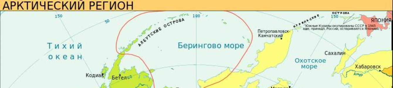
The Arctic Ocean - stretched between Eurasia and North America, and is the smallest ocean on our planet. Its area is 14.75 million square meters. km. at an average depth of 1225 meters. The greatest depth is 5.5 km. be in the Greenland Sea.

In terms of the number of islands and archipelagos, the Arctic Ocean ranks second after the Pacific Ocean. In this ocean there are such largest islands and archipelagos as Greenland, Franz Josef Land, Novaya Zemlya, Severnaya Zemlya, Wrangel Island, New Siberian Islands, Canadian Arctic Archipelago.
The Arctic Ocean is divided into three 3 large areas:
- arctic basin; The center of the ocean, its deepest section reaches 4 km.
- North European Basin; It includes the Greenland Sea, the Norwegian Sea, the Barents Sea and the White Sea.
- continental shelf; It includes the seas washing the continents: the Kara Sea, the Laptev Sea, the East Siberian Sea, the Chukchi Sea, the Beaufort Sea and the Baffin Sea. These seas account for more than 1/3 of the total area of the ocean.

Simplified to represent the topography of the ocean floor is quite simple. The continental shelf (maximum width 1300 km) ends with a sharp drop in depth to 2-3 km, forming a kind of step that surrounds the central deep part of the ocean.
This natural bowl with a depth in the center of more than 4 km. dotted with many underwater ridges. In the 50s of the 20th century, echolocation of the bottom showed that the Arctic Ocean is dissected by three trans-oceanic ridges: Mendeleev, Lomonosov and Gakkel.
The waters of the Arctic Ocean are fresher than other oceans. This is explained by the fact that large rivers of Siberia flow into it, thereby desalinating it.
CLIMATE

From January to April, there is an area of high pressure in the center of the ocean, better known as the Arctic High. In the summer months, on the contrary, lower pressure prevails in the Arctic basin. The pressure difference constantly brings cyclones, precipitation and wind up to 20 m/s to the Arctic Ocean from the Atlantic. On their way to the center of the ocean, a huge number of cyclones pass through the North European Basin, causing dramatic weather changes, heavy rainfall and fog.
The air temperature ranges from -20 to -40 degrees. In winter, when 9/10 of the ocean area is covered with drifting ice, the water temperature does not rise above 0 degrees Celsius, dropping to -4. The thickness of drifting ice floes is 4-5 meters. Icebergs are constantly found in the seas surrounding Greenland (the Baffin Sea and the Greenland Sea). By the end of winter, the ice area reaches 11 million square meters. km. Only the Norwegian, Barents and Greenland Seas remain free of ice. The warm waters of the North Atlantic Current flow into these seas.

Ice islands drift in the Arctic basin, the ice thickness of which is 30-35 meters. The “lifetime” of such islands exceeds 6 years and they are often used to operate drifting stations.

By the way, Russia is the first and only country that uses drifting polar stations. Such a station consists of several buildings where the members of the expedition live, and there is a set of necessary equipment. For the first time such a station appeared in 1937 and was called " North Pole". The scientist who proposed this method of exploring the Arctic - Vladimir Vize .
ANIMAL WORLD
Until the 20th century, the Arctic Ocean was a "dead zone", research was not carried out there due to very harsh conditions. Therefore, knowledge about the animal world is very scarce.

The number of species decreases as one approaches the center of the ocean in the Arctic basin, but phytoplankton develops everywhere, including under drifting ice. It is here that the feeding fields for various minke whales are located. The colder parts of the Arctic Ocean are chosen by animals that perfectly tolerate harsh climatic conditions: narwhal, beluga whale, polar bear, walrus, seal.

In the more favorable waters of the North European Basin, the animal world is more diverse due to fish: herring, cod, sea bass. There is also the habitat of the now almost exterminated bowhead whale.

The fauna of the ocean is gigantic. Here live giant mussels, giant cyanide jellyfish, sea spider. The slow course of life processes endowed the inhabitants of the Arctic Ocean with longevity. Recall that the bowhead whale is the longest-lived vertebrate on Earth.

The flora of the Arctic Ocean is unusually scarce, because. drifting ice does not let the sun's rays through. With the exception of the Barents and the White Sea, the organic world is represented by unpretentious algae, which prevail in the continental shelf. But in terms of the amount of phytoplankton, the seas of the Arctic Ocean can quite compete with the more southern seas. There are more than 200 species of phytoplankton in the ocean, almost half of them are diatoms. Some of them have adapted to live on the very surface of the ice and, during the flowering period, cover it with a brown-yellow film, which, by absorbing more light, causes the ice to melt faster.
It occupies only 4% of the oceans, but washes the shores of several states, such as:
- Denmark.
- Norway.
- Iceland.
- Canada.
- Russia.
Let's take a closer look at the seas of the Arctic Ocean, washing Russia. Their list is quite extensive, and you can find interesting information about each.
Some legal information
The waters of the coldest ocean, located in the northern latitudes of our planet, do not have a clear legal status. All adjacent countries except Iceland claim separate water sectors. This greatly complicates the development of the ocean floor, since there are no agreements on the rights to the territory.
The seas fall under sectoral demarcations. This means that the map is conditionally divided into triangles, the tops of which are the North Pole, and the east and west are the borders of states.
But the UN Convention establishes other demarcation rules, according to which the boundaries are determined not only by the extreme coastal points, but also by the length of the shelf.
characteristics of the seas. Arctic Ocean
The total area of the seas of the most severe ocean is more than 10 million square meters. km. This is approximately 70% of the entire territory. Here, however, scientists attributed the ocean straits and bays. The seas of the Arctic Ocean, which we list below, are divided into marginal and inland.
A common feature can be considered the shallowness of the seas. The fact is that the ocean, located in the northern part of the board, is the smallest of all existing ones. There is a harsh climate, and gusty winds with fogs and heavy precipitation all year round. Floating ice creates difficulties for navigation even at a time when the seas are considered passable. The farther from the coast, the thicker the ice fields, and navigation requires escort of powerful icebreakers.
Despite all the difficulties, most of the year for these harsh waters is considered navigable. Caravans of ships are moving along in an endless stream, since here is the shortest road from the western to the eastern border of the Russian Federation.

Seas of the Arctic Ocean
The list of water bodies belonging to the basin of the ocean located at the North Pole consists of ten seas, six of which wash the shores of the Russian Federation. The largest area is considered to be Barents, which is located in the western part of the Eurasian continent. But the deepest is recognized as the depth of which reaches about 5500 m.
The Norwegian Sea is considered the warmest of all northern water bodies, as its warm current prevents the waters from freezing even in winter. The temperature is at least 2 degrees Celsius in winter and about 8-12 in summer.
What seas of the Arctic Ocean do we know? The list of the northern, harsh water bodies of the planet will be as follows:
- Norwegian. Washes the shores of Iceland and the Scandinavian Peninsula.
- Greenlandic. Located between the east coast of Greenland and the western border of Iceland.
- Barents. Sea located in the western part of Russia.
- White. Northern coast of Europe.
- East Siberian. It washes the coast of Russia, is located among the Novosibirsk and Wrangel Islands.
- Karskoe. The eastern boundary of the sea runs along the Severnaya Zemlya archipelago, while the western boundary borders on the coastline of a large number of islands, including Novaya Zemlya.
- Baffin. It runs along the western border of the island of Greenland, and on the other hand washes the shores of the Arctic Canadian archipelago.
- Laptev. It washes the shores of Taimyr, the New Siberian Islands and Severnaya Zemlya.
- Beaufort. The coastline of the North American continent, from Cape Barrow to the Canadian Arctic Archipelago.
- Chukchi. It washes the shores of two continents: Eurasia and North America.

Six cold seas of Russia
The Arctic Ocean, the seas of which are washed by the Russian shores, was once called the Hyperborean. There were many more names, and only in 1935 the government of the then Soviet Union recognized today's name. But it is worth noting that on many foreign maps the name "Arctic Ocean" is spelled out, which is recognized by the London Geographical Society.
Consider the seas of the Arctic Ocean. The list of Russia consists of six names of marine reservoirs, each of which we will study separately.
Only one of them (Beloe) is classified as inland water bodies, and the other five are classified as continental-marginal.
Barents Sea
Location - the westernmost part. It is on the North European shelf. Among the Russian seas, the Barents Sea is the largest. A significant difference from other reservoirs of this region is year-round navigation. Most of the Barents Sea does not freeze.
Its depth is from 200 to 600 m. Numerous bays make it possible to equip convenient ports protected from strong winds.
The commercial value of the Barents Sea is very noticeable for Russia. It is found here, sea bass, cod fish, haddock, halibut flounder and herring.

Chukchi Sea
Location - the northeastern outskirts of Asia and the northwest of North America. The area is relatively small - about 600 thousand square meters. km. Depth - from 71 to 257 m. The climate can be classified as severe, since the warmest temperature in summer is about +7 ° С.
Fishing and sea animal slaughter are poorly developed. Transportation is carried out, mainly transit, through Pevek.
White Sea
Location - north of Europe. The area is only 90 thousand square meters. km. Depth - from 100 to 330 m. The climate gradually changes from oceanic to continental. The weather is cool and unstable.
The salinity of the sea is about 24-30 ppm. This is due to the fact that several fresh rivers flow into its waters.
The White Sea has a seasonal ice cover. Ice is 90% floating. The fauna of the sea is very diverse. Beluga whales, seals, walruses, seals and many birds live here. In industrial volumes, kelp (seaweed), White Sea herring and cod are harvested.
Laptev sea
The area of this sea is approximately 650 thousand square meters. km. For the seas of this region, the depth is quite large - an average of 520 m.

It is considered the most severe, since the winters are very frosty, and the waters are frozen all year round. Winter lasts almost 10 months. Frost during this period can be -55 ° C. In summer the temperature is slightly above zero.
East Siberian Sea
Location - beyond the Arctic Circle. The area is approximately 915 thousand square meters. km. Depth difference from 54 to 915 m.
The climate is arctic. Winters are clear, with frosts down to -30 °C. Wet snow often falls in summer. In winter, the sea is covered with ice.
The flora is represented by whitefish species. In addition, the inhabitants are polar bears, seals and walruses.
The sea is navigable.
Kara Sea
Area - more than 880 thousand square meters. km. This allows us to attribute the sea to the list of the largest in Russia. Depth - from 110 to 600 m.
The climate is polar maritime. In winter, frosts can reach -50 °С, but in summer the air warms up to +20 °С.

Many islands have formed in it, and its coast is indented with bays. The salinity of water is affected by the flow of large freshwater rivers.
The animal world is represented by several types of fish - flounder, navaga, char. Mammals - hare, seal, beluga, walrus. The islands are richly populated with birds.
The seas of the Arctic Ocean (which we have listed in this article) have recently suffered from human activities. This is because in the North they mine a large number of mineral. In this regard, Russia faces the question of preventing pollution of the seas washing its shores.
- the smallest of the oceans of the Earth. Its area is almost 15 million km2. The ocean is located in.
and occupies vast areas around the North Pole.
The exploration of the Arctic Ocean is a chain of heroic deeds of many generations of sailors. In ancient times, Russian coast-dwellers set off on a journey on fragile wooden boats and boats. They fished, hunted and knew well the conditions of navigation in the polar latitudes. One of the most accurate maps of the western part of the ocean was compiled following the voyage of Willem Barents in the 16th century, who attempted to find the shortest route from the countries of the East. The beginning of a systematic study of the coasts of the ocean is associated with the names of many sailors and travelers: S.I. Chelyuskin, who discovered the northern tip, described the part; Lapteva D.Ya. and Laptev Kh.P., who examined the coast of the ocean to the east and west from the mouth of the river; ID Papanin, who made a heroic drift on an ice floe from the North Pole with three polar explorers to develop new methods for studying the ocean, and others. The names of many of them remained in the names on the map.
The maximum depth of the ocean is 5527 meters. A characteristic feature is a large shelf, the width of which sometimes reaches 1300-1500 km. The central part is crossed by mountain ranges and deep faults, between which lies a hollow.
The presence of ice is the most characteristic feature of this ocean. Their formation is associated with low temperature and low salinity of ocean waters. and currents cause the movement of ice, which form huge heaps - hummocks - due to strong lateral compression. Cases are known when ships caught in ice captivity were crushed or squeezed up.
The bulk of organisms in the ocean are algae that can live in cold water and even on ice. Life is rich only in the Atlantic region and on the shelf near the mouth of the rivers. Fish live here: cod, navaga, halibut. Whales, seals, walruses live in the ocean. In the bulk of the plankton of the ocean is formed. This attracts many birds here in the summer, forming bird "markets" on the rocks.

The Arctic Ocean is extremely important for many: Russia, Canada and others. The harsh nature makes it difficult to search there. But deposits have already been explored both on the shelf and the seas, off the coast of Alaska and. Sediments rich in various ores were found at the bottom.
Biological wealth is small. In the Atlantic latitudes, they fish and extract algae, hunt seals, icebergs, drifting up to 6 years or more.
The smallest and coldest ocean on our planet is the Arctic Ocean. It is located in the central part of the Arctic, to the north of such continents as: North America and Eurasia. The area of the ocean is 15 million square kilometers, it occupies a wide area around the North Pole.
Characteristics of the Arctic Ocean:
Ocean area - 14.7 million square km;
The maximum depth - 5527 meters - is the shallowest ocean on the planet;
The largest seas are the Greenland Sea, the Norwegian Sea, the Kara Sea, the Beaufort Sea;
The largest bay is Hudson Bay (Hudson);
The largest islands are Greenland, Svalbard, Novaya Zemlya;
The strongest currents:
- Norwegian, Svalbard - warm;
- East Greenland - cold.
History of exploration of the Arctic Ocean
The goal of many generations of navigators is a series of heroic deeds in its exploration; even in ancient times, Russian coast-dwellers traveled on wooden boats and kochas. They knew well the conditions of navigation in the polar latitudes, and were engaged in hunting and fishing. One of the most accurate maps of the Arctic Ocean was compiled by Willem Barents in the 16th century following his travels, who was trying to find the shortest route between Europe and the countries of the East. But the ocean began to be studied in more detail at a later time.

In the study of the ocean, the works of famous travelers and scientists were involved: Chelyuskin S.I., who explored the northern tip of Eurasia, describing part of the coast of Taimyr; Lapteva Kh.P. and Lapteva D.Ya., who marked the coasts of the ocean to the west and east from the sources of the Lena River; Papanina I.D., who, with three polar explorers, drifted on an ice floe from the North Pole to Greenland, and others. Many of them have fixed their names in names of geographical significance. In 1932, Otto Schmidt, together with an expedition on the icebreaker Sibiryakov, established the thickness of ice sheets in various parts of the ocean. Today, research continues with modern technologies and spacecraft.
Features of the climate of the Arctic Ocean
The modern climate of the ocean is determined by its geographic location. In most cases, arctic air masses predominate. The average air temperature in winter ranges from -20 degrees to -40 degrees Celsius, while in summer the temperature is close to zero.
Replenished with warmth from the Atlantic and Pacific Oceans, the water of the ocean does not cool in winter, but significantly warms the shores of the land. Due to the constant replenishment with fresh water from the Siberian rivers flowing into it, the water of the Arctic Ocean is less salty in relation to other oceans.
The presence of huge masses of ice is the most characteristic feature of the Arctic Ocean. For ice, the most favorable habitat is a low temperature and low salinity of the water. Strong currents and constant winds under the influence of strong lateral compressions form ice heaps - hummocks. There have been cases when ships caught in ice captivity were pushed up or crushed.
Hummocks of the Arctic Ocean

There is no time at the North Pole (as well as the South Pole). The time always shows noon because all lines of longitude converge. Working people in this region use the time of the country they come from. Sunset and sunrise occur here once a year. Due to the geographical position, the sun in these latitudes rises in March and the longest day on earth sets in, equal to half a year (178 days), and sets in September, starting the polar night (187 days).

Flora and fauna of the Arctic Ocean
Compared to other oceans, flora and fauna are quite poor. The bulk of organic matter is algae, which are adapted to life in icy water and even on ice. Diversity flora prevails only in the near-Atlantic area of the ocean and on the shelf near the mouths of rivers. Fish are found here: saffron cod, cod, halibut. Whales, walruses and seals live in the ocean. In the area of the Barents Sea, the bulk of the plankton of the ocean is formed. In summer, many birds fly here, which form bird "markets" on the ice rocks.

AT modern world many states are trying to divide the area of the Arctic Ocean. The places are rich in deposits. According to some data, the richest deposits of gas and oil are located in the waters of the ocean. Rich deposits of various ores have been discovered in the area of the Laptev Seas. Severe weather makes it difficult to find them. The Arctic Ocean, despite its shortcomings, has always attracted people from all over the planet. It attracts them to this day.
If you liked this material, share it with your friends in social networks. Thank you!